Topographic maps, offline mode, GPS tracker and track creator.
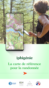
Iphigénie is the most complete and popular app for IGN maps.
Everyone understands the need for a map; to prepare for an outing, a walk, a hike, a trip or simply to know where you are and about the environment that surrounds you. Iphigénie is a complete mapping app which – thanks to more than 40 maps – will allow you to find your way anywhere in the world.
We include some of the most popular maps in the world:
– OpenTopoMap (worldwide topography)
– OpenSnowMap (worldwide ski slopes)
– French IGN topographic national maps
– SwissTopo maps
– Spanish topographic maps
– Norwegian topographic maps
and many others*…
But much more than just your location on a map, iPhigénie offers you a variety of tools that will allow you to prepare, follow, record, archive and share your outings.
PREPARE
– download maps for offline access
– create, edit, import GPS tracks
– position, import useful markers (e.g. avalanche path, mushroom spots….)
– 3D view
FOLLOW
– follow a GPS track (with optional guidance sounds to keep you on-track)
– customised vocal alerts
– information like distance covered, distance remaining, estimated arrival time
– beacon, to allow chosen contacts to follow your outing progress in real time.
RECORD
– record your track, your position
– information like distance covered, elevation gain and loss, average and current speed
ARCHIVE
– Tracks and markers saved in a folder
– Cloud access
SHARE
– export your tracks and markers in GPX format
By selecting Iphigénie, you enjoy not only a complete and stable application, but also a customer-focused team available to answer all your questions and assist you as you progress.
So, if you encounter any difficulty with the app, do not hesitate to contact us: aide.iphigenie(at)gmail.com
*AVAILABLE MAPS :
Note : editor subscription needed for marked “**” maps
IGN France
Topographic and road maps (current, 1950)**, Scan 1/25k all scales**, OACI (aviation)**, ESRI** (worldwide), French satellite view (current, 1950-1965, 2000-2005, 2006-2010), cadastre**, French administrative limits, Plan IGN V2, slopes 30° 35° 40° 45°, restricted drone areas, 19th century maps, Paris satellite view (1818-1824, 1906, 1965-1980).
SwissTopo
Topographic and road maps, satellite view, hiking trails, gliding maps, OACI (aviation), geological maps, slopes >30°.
IGN Belgium
Topographic and road maps (Cartoweb)**.
Institut Cartogràfic de Catalunya
Topographic maps.
Instituto Geografico Nacional (Spain)
Basic maps, topographic and road maps.
Bundesamt für Kartographie und Geodäsie (Germany)
Topographic and road digital maps
Kartverket (Norway)
Topographic and road maps
OpenTopoMap.org (worldwide)
OpenTopoMap.
OpenCycleMap (worldwide)
OpenCycleMap, landscape, transport, outdoor.
OpenSnowMap (worldwide)
Ski areas, pistes and trails.
Geological and Mineral Research Bureau (France)
Geological maps.
Forests National Office (France)
Public forest delimits, public forest plots.
NOTES:
Beacon : WARNING, do not rely solely on this feature for safety. Planning, communication and knowledge are the ultimate tools for safety in the mountains.
Apple Store subscriptions are recurrent, their renewal is automatic.
** Editor subscription required
*** Amax module purchase is required to access Iphigénie’s tools (this is not a subscription) – without Amax module you only get access to your location on the map.

Apkjio.com developer simply want to remove ads or unlock premium features that would otherwise require a purchase. Also want to add new features or customization options to an app that the original developer did not include.safe verified